


05 bis GMTC Pompeyrin-Le Giraldès (variante)

nicolas54230
User

Length
58 km

Max alt
1495 m

Uphill gradient
1245 m
Km-Effort
75 km

Min alt
935 m

Downhill gradient
1132 m
Boucle
No
Creation date :
2019-05-19 15:02:57.589
Updated on :
2019-05-19 15:19:24.013
57m
Difficulty : Easy

FREE GPS app for hiking
 SityTrail
IGN / Geographical institutes
SityTrail Plus
The world is yours!
About
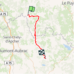
Trail Mountain bike of 58 km to be discovered at Auvergne-Rhône-Alpes, Haute-Loire, La Besseyre-Saint-Mary. This trail is proposed by nicolas54230.
Positioning
Country:
France
Region :
Auvergne-Rhône-Alpes
Department/Province :
Haute-Loire
Municipality :
La Besseyre-Saint-Mary
Location:
Unknown
Start:(Dec)
Start:(UTM)
533452 ; 4978677 (31T) N.
Comments